

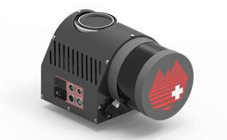
LS Nano V16
The LS Nano V16 is a mini Lidar system specially designed to meet the market need for Multi-copters. System consists of a Velodyne VLP-16 scanner, a 20mp mini camera, a suitable POS system and LidarsSwiss proprietary control unit. With a 2.3 kg weight, this makes the Lidar system a perfect tool for low altitude small areas and corridor mapping, and with a an Easy-to-install-and-operate feature it ensures that this baby Lidar system can generate a desirable result even with little training. The LS Nano V16 is coupled with Geo-LAS software to process the acquired data, creating measurable terrain models in a very short time.
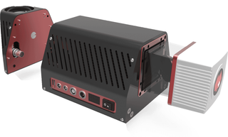
LS MICRO VUX LR
The LS Micro VUX LR is the next generation of LIDAR solutions, making it suitable for both corridor and area mapping. Based on VUX-1LR, it has a higher grade NovAtel IMU/GPS, and a 50mp calibrated camera, making the LS Nano VUX LR lighter, capable of longer ranges, higher altitudes, and covers more area on both manned and unmanned platforms. The
LS Micro Vux LR also automatically collects highly accurate laser and image data via its on-board system controller, and can produce DOM's DEMs, DSMs and DTMs which may be further processed to produce 3D models for various industries.
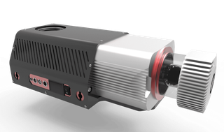
LS Nano VUX QX1
The LS Nano Vux QX1 is an easy to transport, easy to install, and easy to operate piece of equipment. It is the perfect tool for rapid and accurate 3D data gathering in small areas. The LS Nano Vux QX1 is suited for electronic multi-copters or other flying platforms and consists of a LS Nano Vux Base Lidar system and LS single camera pod. Weighing in at 2.95 kg
the LS Nano Vux QX1 uses surveying grade IMU/GPS solutions to calculate accurate positions. While flying the Lidar system automatically collects and in real-time processes data via the on-board Geo controller
and LidarSwiss proprietary Geo-RT software. The RGB attributed laser data can output while landing or transferred to the ground station during flight. The algorithm that it uses to process precise positions and generate 3D data for all objects above ground has proven highly-accurate by surveying & mapping third parties.