
PHOENIX LiDAR SYSTEMS

Multi-Platform LiDAR Solutions
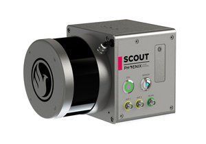
The Scout
Low cost, excellent accuracy, multi-vehicle compatible LiDAR mapping system.
The Scout is the best combination of weight, cost, performance, & capabilities. Modular components exist for LiDAR mapping, multi/hyperspectral sensing, hybrid-SLAM and photogrammetry. Multiple options for higher density and/or more accurate point clouds.
Features
- Real-time point cloud transmission option via 4G or long-range wifi
- Fully autonomous, can be mounted on any drone, car, boat and/or even backpacks – works in multiple orientations
- Modular upgrade options: Dual LiDAR Sensors, DSLR, GeniCam, GigEVision, thermal, multispectral, hyperspectral & custom sensors.
- 360° field of view
- Optional IMU and Dual-GPS upgrade
- SDK option for Real-Time point cloud data
- Designed by surveyors for surveyors
Specs
- Absolute Accuracy:
55 mm RMSE @ 50 m Range - PP Altitude Heading RMS Error:
0.019 / 0.074º IMU options - Weight:
1.6 kg / 3.5 lb - Overall Dimensions:
160 * 116 * 116 mm - Laser Range:
80 m @ 60% - Scan Rate:
300k shots/s, up to 2 returns