
PHOENIX LiDAR SYSTEMS

Multi-Platform LiDAR Solutions
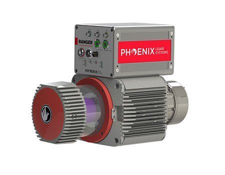
Ranger Series
Survey-grade LiDAR mapping system with precision LiDAR and Fiber Optic Gyro (FOG) IMU.
The Ranger Series is designed for the most demanding mapping applications, no compromises made. With a 1350 meter laser range, this system produces photorealistic 3D point clouds of very large regions. The Ranger is a true universal payload in that it's designed for manned and unmanned aircraft as well as ground vehicles.
Features
- Survey-grade (cm-level) accuracy with 1000m+ laser range and outstanding intensity calibration
- IMU and dual-GPS upgrade options for increased accuracy
- Modular upgrade options: Dual LiDAR Sensors, DSLR, GeniCam, GigEVision, thermal, multispectral, hyperspectral and custom sensors
- Fully autonomous, can be mounted on any drone, car, boat and/or even backpacks
- Designed by surveyors for surveyors
Specs
- Absolute Accuracy:
25 / 35mm RMSE @ 250m Range - PP Altitude Heading RMS Error:
0.007 / 0.009° IMU options - Weight:
5.3 kg / 11.7 lb - Overall Dimensions:
30.8 L x 18 W x 12.9 H (cm) - Laser Range:
1350m @ 60% - Scan Rate:
750k shots/s, up to 7 returns